Exploring Geophysical Data
Congratulations, you’ve found some-predownloaded data and plotted it, you’re halfway there! Now you need to find some new data online and plot it in exactly the same way as before.
This exercise will walk you through a case study of where to find the different datasets, and how to download them. Be mindful of where you’re downloading to, as the local computers will not have as much space as the harddrives you’ve got, but the harddrives aren’t connected to OneDrive, so you can’t work on them remotely.
1. Finding the variable you want
You’ll find all the data on the ESA Climate Dashboard.
If you scroll down, you’ll find an area that looks like this.
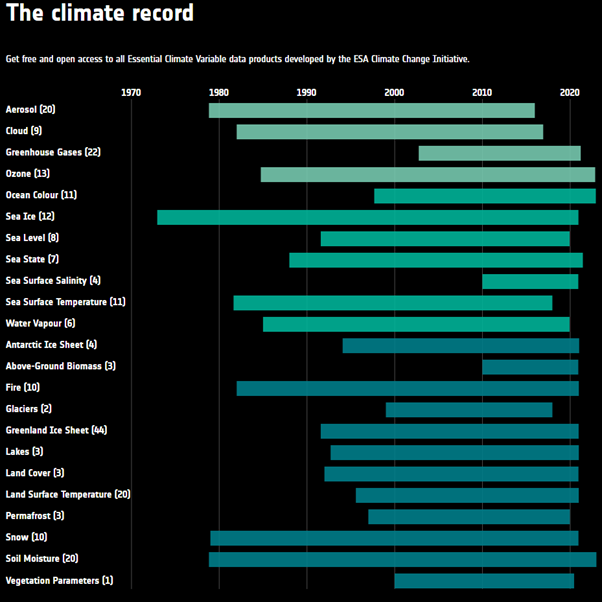
From this, you can see each variable measured, the number of data products per variable, and the timespan for each variable. Click on the Sea Surface Temperature variable.
2. Finding the dataset you want
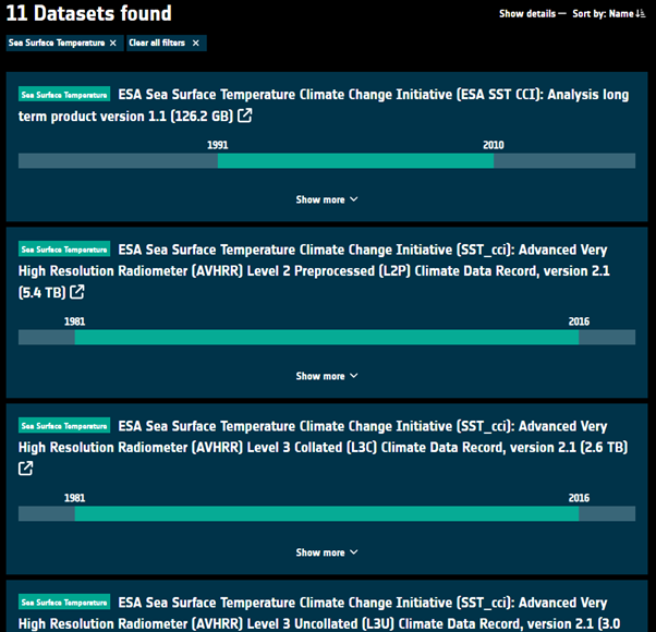
These show the different products that are associated with sea surface temperature, including the size of each product. It is very easy to download large amounts of data and not have it properly organised, so make sure you’ve created a well organised file system. If you click show more on any dataset, you can find out more useful information about each.
Go into the dataset called ESA Sea Surface Temperature Climate Change Initiative (SST_cci): Climatology Climate Data Record, version 2.2 (3.2 GB), the eighth one down.
3. Understanding the dataset
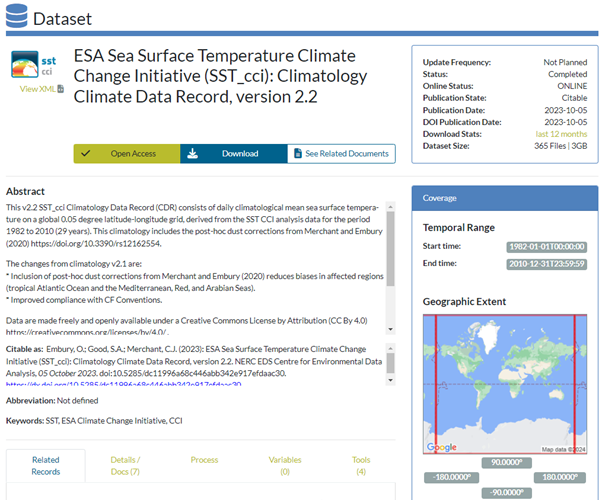
This is quite a busy webpage, but it can be broken down. The Abstract gives a brief overview of the data and sometimes the instrument used to collect the data. The Coverage section on the right shows where and when the data is collected from.
Click on the blue Download button.
4. Finding the files you want.
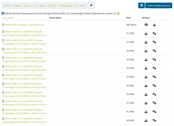
You can see the downloadable files in green, each one named slightly differently depending on the date. In this case, the files show yearly means of each day. Download the D001-ESACCI-L4_GHRSST-SSTdepth-Climatology-GLOB_CDR2.2-v02.0-fv01.0.nc file.
Once you’ve downloaded the data, use the tools you gained in the previous exercise to plot the data.
(Hint, sst means sea surface temperature)
Remember to give the figure a title, and the axes labels.
Why not try plotting the difference from one day to another day halfway through the year?
Why not try plotting a specific region? (i.e., Europe) You’ll need to use array indexing for this.