
|
||||
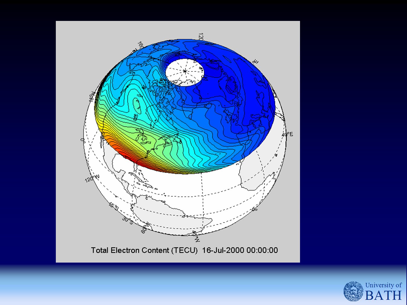
Multi-Instrument Data Analysis SystemMIDAS is an advanced algorithm for imaging the Earth's ionosphere using data from various ground and space-based instrumentation. Line integral observations of the total electron content (TEC) obtained from a network of ground-based and space-based GPS receivers may be assimilated into the algorithm along with point estimates of the local electron density. The resulting reconstructions provide a highly accurate three-dimensional image of the Earth's ionosphere and its evolution in time. Example outputs of MIDAS include: The MIDAS package was developed under MATLAB and includes libraries for a number of external models. The package will run under both Windows and UNIX platforms. MIDAS is available under license from the University of Bath. Contact Dr Cathryn Mitchell, C.N.Mitchell@bath.ac.uk
|

|
Department of Electronic and Electrical Engineering, University of Bath, Bath BA2 7AY. Tel: +44 (0)1225 386063 Fax: +44 (0) 1225 386305 E-mail: C.N.Mitchell@bath.ac.uk Copyright ©2005 University of Bath Disclaimer, Privacy Statement. |