Ionospheric tomography
Much of the satellite data assimilated by the MIDAS system is in the form of line integral observations of the total electron content (TEC) from satellite to ground-based receiver. The problem of inverting this data to provide a three-dimensional image of the ionosphere is essentially a tomographic inverse problem. Early work using polar orbiting satellites proved very useful in imaging structures in the two dimensional plane of the satellite orbit. MIDAS was developed to extend these methods to the case of a three dimensions so as to enable the imaging of the ionosphere ver larger spacial scales using GPS satellite data.
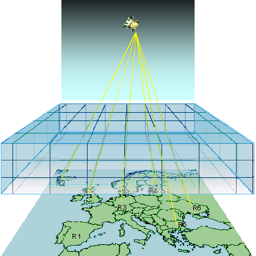
Mathematically, the approach used by MIDAS involves computing the delay of the radio waves from satellite to receiver through a three-dimensional grid encompassing the ionosphere. This representation of the electron-density distribution is then mapped to one combining spherical harmonics and empirical ortho-normal functions in the radial dimension. The resulting linear inverse problem may then be solved using a matrix inversion technique. The final step involves mapping back to determine the electron density field.